
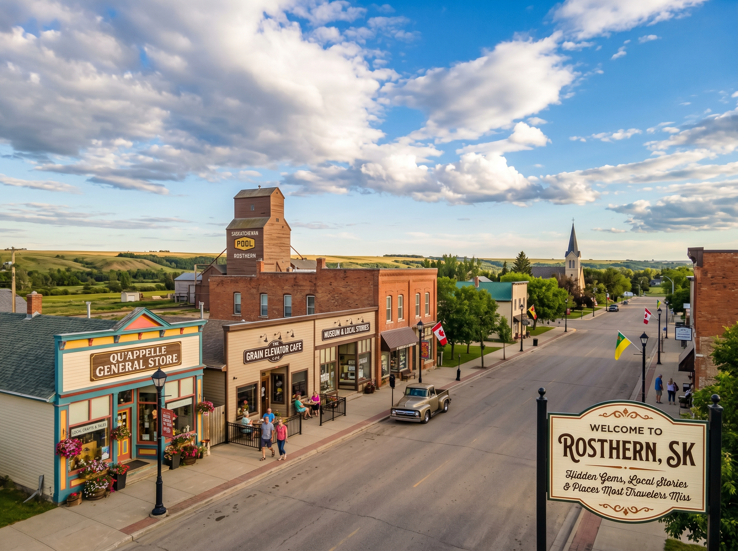
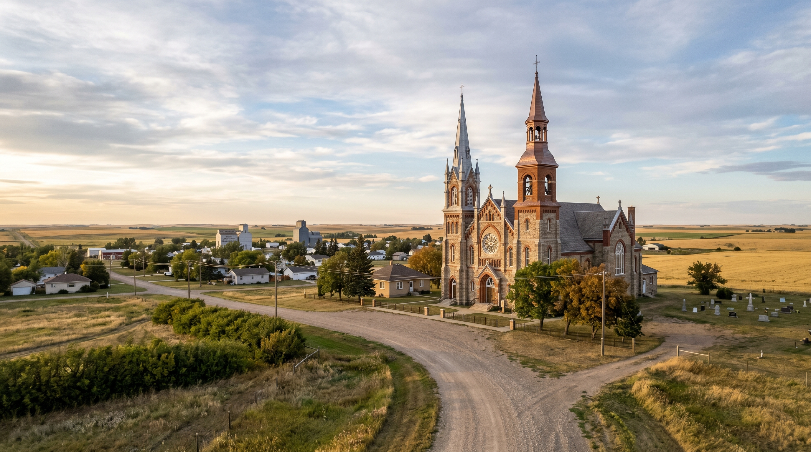
Last Updated on May 4, 2026 by Jeremy
Most people don’t think of hidden gems in Saskatchewan as something worth planning around. They drive through, see flat land stretching in every direction, and assume they’ve already seen everything there is to see. That assumption is exactly why so many underrated places in Saskatchewan get missed completely, not because they’re hard to reach, but because nothing is telling you to stop.
The reality is, the best secret spots in Saskatchewan aren’t built as attractions at all. They’re quiet landscapes, overlooked towns, and subtle shifts in the land that only stand out when you start paying attention differently. When you stop looking for obvious highlights and start noticing what’s actually there, the province changes, and so does the way you move through it.
Quick Answer: Hidden gems in Saskatchewan are not major attractions or heavily promoted stops. They are quiet places that most travelers drive past without noticing, including unexpected landscapes like the Big Muddy badlands, small towns with deeper local stories like Roleau and the Battlefords, and subtle features like the Sinking Hills that only stand out when you know where to look.
This guide focuses on underrated places in Saskatchewan that offer real depth. You will learn where they are, why they matter, what they feel like to experience, and how to build a trip around them without treating the province like a checklist.
Why most people miss these places
Most people miss hidden gems in Saskatchewan because they never show up in the places travelers usually look. Search results, travel platforms, and booking sites tend to highlight the same well-known destinations, which means smaller or locally known spots rarely surface at all.
If you browse official tourism resources like Tourism Saskatchewan, you’ll notice the focus leans toward major parks, lakes, and established attractions. The same pattern shows up on platforms like TripAdvisor, where visibility depends on reviews, listings, and structured experiences. If a place doesn’t have those, it simply doesn’t appear.
On top of that, Saskatchewan is often treated as a drive-through province rather than a destination. The scale of the landscape adds to that problem. Long stretches of similar terrain make subtle changes easy to overlook, especially if you’re not expecting anything different.
What fills that gap is local knowledge. The kind that doesn’t always make it online, but gets passed along through people who’ve spent time out there and know what’s worth stopping for.
How this Saskatchewan hidden gems route works
This is not a strict itinerary where every stop needs to be checked off in order. Saskatchewan is too spread out for that, and honestly, forcing it into a rigid list would ruin the point. The better way to explore it is through geographic clusters, using larger towns and cities as anchors while letting the smaller places fill in the story.
The route below moves through six broad regions: southwest, south-central, southeast, central-east, north-central, and northwest. That gives the article a natural loop while keeping each place where it actually belongs geographically. Some stops are major enough to plan around. Others are better treated as detours, meal stops, or context pieces that make the drive more interesting.
| Cluster | Main feel | Places included |
|---|---|---|
| Southwest | Badlands, elevation, open range | Maple Creek, Cypress Hills, Red Coat Trail, Hazenmore, Big Muddy, Castle Butte, Grasslands |
| South-Central | Local stories, subtle discoveries, prairie towns | Ponteix, Aneroid, Vanguard, Hallonquist, Sinking Hills |
| Southeast | Coal country, rural roads, quiet prairie communities | Weyburn, Estevan, surrounding small-town stops |
| Central-East | Underground history, pop culture, valley landscapes | Moose Jaw, Regina, Roleau, Fort Qu’Appelle Valley |
| North-Central | Water, Indigenous history, river valleys | Lake Diefenbaker, Outlook, Gardiner Dam, Saskatoon, Wanuskewin, Batoche |
| Northwest | Historic weight, forest transition, northern scale | The Battlefords, Prince Albert National Park, Waskesiu, Meadow Lake region |
1. Southwest Saskatchewan: Badlands, elevation, and open range
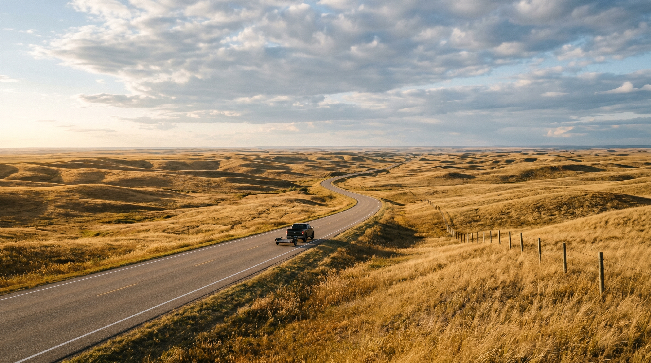
Southwest Saskatchewan is where the province starts arguing with the stereotype people have of it. The land is not just flat. It rises, cuts, rolls, and eventually drops into places that feel more like a western film set than the prairie most travelers expect.
This cluster works best if you treat it as a slow-driving region rather than a single destination. You could use Swift Current or Maple Creek as a base depending on how far you want to push, then work your way toward Cypress Hills, the Red Coat Trail, Grasslands, and the Big Muddy. Distances matter here, and so does daylight. This is not the region to race through while pretending every gravel road is just another shortcut.
Maple Creek and Cypress Hills
Maple Creek makes sense as one of the first real anchors in the southwest because it sits close to one of Saskatchewan’s biggest expectation-breakers: Cypress Hills. This is where the province suddenly gains height, tree cover, and a completely different mood. If someone tells you Saskatchewan is all flat, this is one of the easiest places to prove they stopped paying attention too early.
Cypress Hills works because the contrast is immediate. You move from open prairie into elevated forest and rolling terrain that feels closer to foothills than farmland. It is one of those areas that makes you understand why a Saskatchewan road trip should not be planned only by looking at highway lines on a map.
For travelers, this is a good place to slow down and reset. You can pair it with Maple Creek, nearby scenic drives, local stays, and a broader southwest loop. It gives the trip elevation before you move into places that are more rugged and less polished.
Red Coat Trail and Hazenmore
The Red Coat Trail is not one single hidden gem. It is a stretch that makes the act of driving feel like part of the story. Roads like this matter in Saskatchewan because so much of the experience happens between towns, not just inside them.
Hazenmore fits that idea perfectly. It is not a place most travelers would build an itinerary around, but if you know the area, it becomes a meaningful pause in the route. The Red Coat Inn is the kind of local stop people remember because it has earned its reputation quietly, especially for the pepper steak people still talk about.
That detail matters. Not because a meal turns a town into a tourist destination, but because this is exactly how hidden gems in Saskatchewan often work. They are not loud. They are remembered through repeat stories, local recommendations, and people saying, “if you’re passing through there, stop for this.”
Big Muddy and Castle Butte
The Big Muddy is one of the strongest landscape shifts in the province. It does not ask for much imagination. You arrive and the land simply looks different. The prairie breaks into badlands, the horizon drops into ridges and draws, and Castle Butte rises as the obvious landmark in a region that already feels like it is hiding something.
Castle Butte itself is a standout, but the wider area is what gives it depth. This region carries Indigenous history, early settler history, Northwest Mounted Police movement, and old outlaw stories. That mix gives the Big Muddy a different tone than a scenic stop. It feels like a place shaped by people moving through carefully, sometimes because they wanted to avoid being found.
Practical planning matters here. Some Big Muddy sites involve private land or guided access, and you should not assume every road or formation is open for casual wandering. This is the kind of place where a local tour or visitor centre can make the difference between seeing a landmark and actually understanding what you’re looking at.
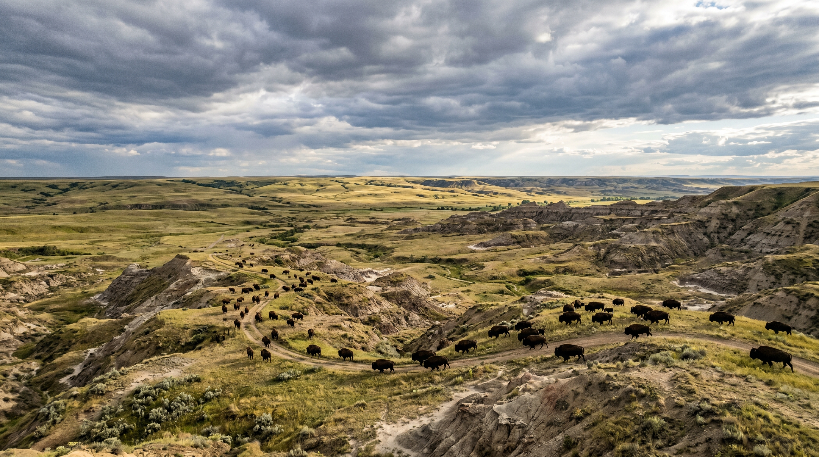
Grasslands National Park and Val Marie
Grasslands National Park is more known than some places in this guide, but it still fits because it remains under-visited compared with Canada’s more obvious national parks. It is not trying to impress you with mountains or lakes. It gives you open prairie, dark skies, bison country, badlands, silence, and scale.
Val Marie is often the practical gateway, and that matters because Grasslands is not a quick roadside pullout kind of place. It rewards people who make the effort to stay longer, drive slower, and give the landscape time to work on them. If you show up expecting instant drama, you may miss the point. If you stay until the light changes, the place starts to make more sense.
This region is best in late spring, early summer, or fall. Summer can be beautiful, but heat and exposure are real factors. Bring water, check conditions, respect wildlife distance, and do not treat open prairie like empty space. It is very much alive. You just have to look differently.
Why this cluster is a gem: Southwest Saskatchewan breaks the flat-province assumption fast. It gives you elevation, badlands, grasslands, historic routes, and local food stops in one region.
Best time: Late May to June for greener landscapes, or September for cooler travel, softer light, and fewer people.
2. South-Central Saskatchewan: Local stories and subtle discoveries
South-central Saskatchewan is quieter than the southwest. It does not rely on dramatic badlands or major elevation shifts. This is where the hidden gems become more personal, more local, and easier to miss if you are only looking for scenery.
The towns in this cluster matter because they carry stories that are not always visible from the road. Some are tied to cultural roots. Some are tied to weather events. Some are tied to people who went much farther than the town limits. And then there are places like the Sinking Hills, where the land itself tells a small story that only a handful of locals even think to point out.
Ponteix
Ponteix is one of those towns that rewards curiosity. From the outside, it can look like another quiet prairie community, but it carries a distinct cultural layer through its French roots and Catholic heritage. That gives the town a different identity than many surrounding places, especially when you slow down enough to notice the architecture and local history.
This is not the kind of place where you rush in expecting a polished attraction. It works better as a stop that adds texture to the route. You begin to see how Saskatchewan was shaped by different settlement patterns, languages, churches, families, and small communities that held onto identity even when the wider landscape seemed to flatten everything into one prairie label.
Ponteix also fits this article because it shows how hidden gems are not always about the biggest visual payoff. Sometimes the gem is the fact that a town still carries a specific story, even if most travelers would never know to ask about it.
Aneroid
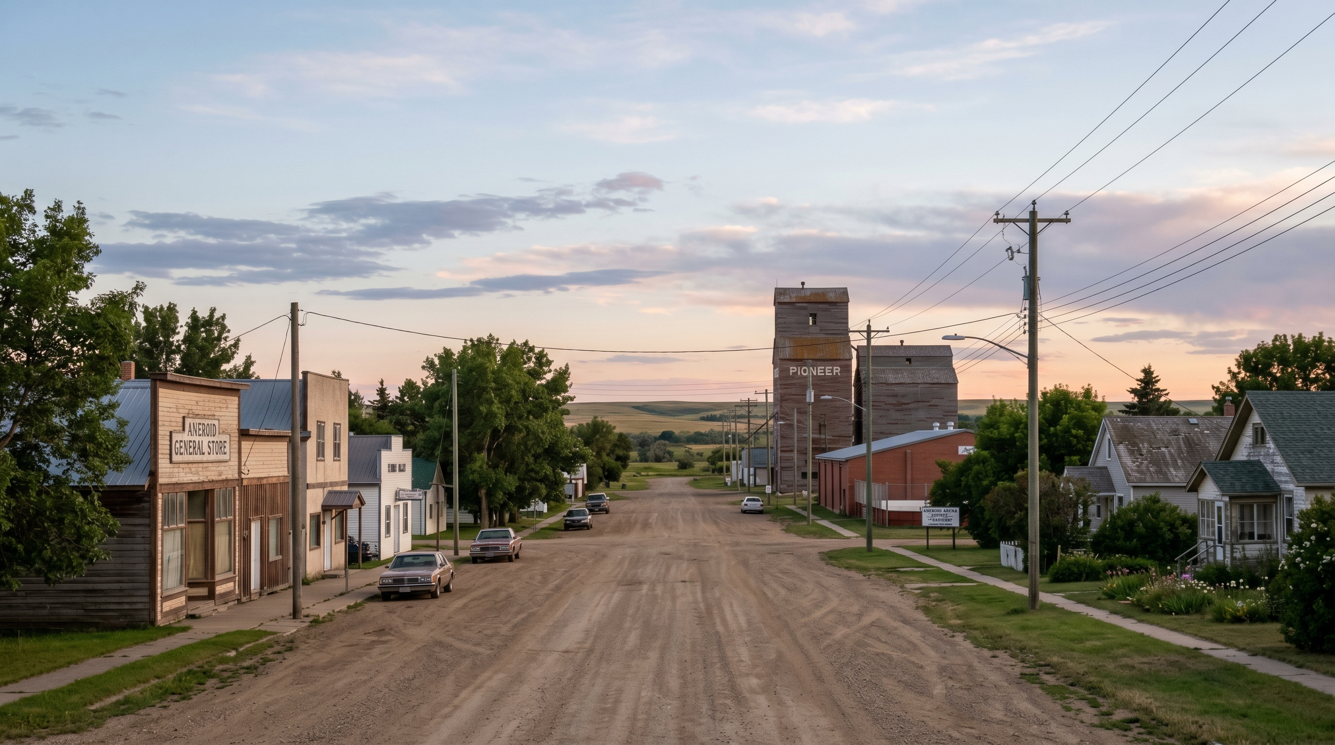
Aneroid is small enough that many travelers would pass it without thinking twice, but it has one connection that gives it a wider reach: Patrick Marleau. For hockey fans, that matters. Marleau’s career stretched far beyond Saskatchewan, but his roots point back to a place that most people outside the region would never think to search.
That contrast is what makes Aneroid interesting. It is not trying to be a hockey tourism destination. It does not need to be. The value is in recognizing that big stories can begin in places that look almost too quiet to hold them.
As a stop, Aneroid works best as part of the south-central story rather than a standalone destination. It adds a human layer to the route. You are not just looking at landscapes anymore. You are moving through towns that produced people, stories, and memories that traveled much farther than the roads themselves.
Vanguard
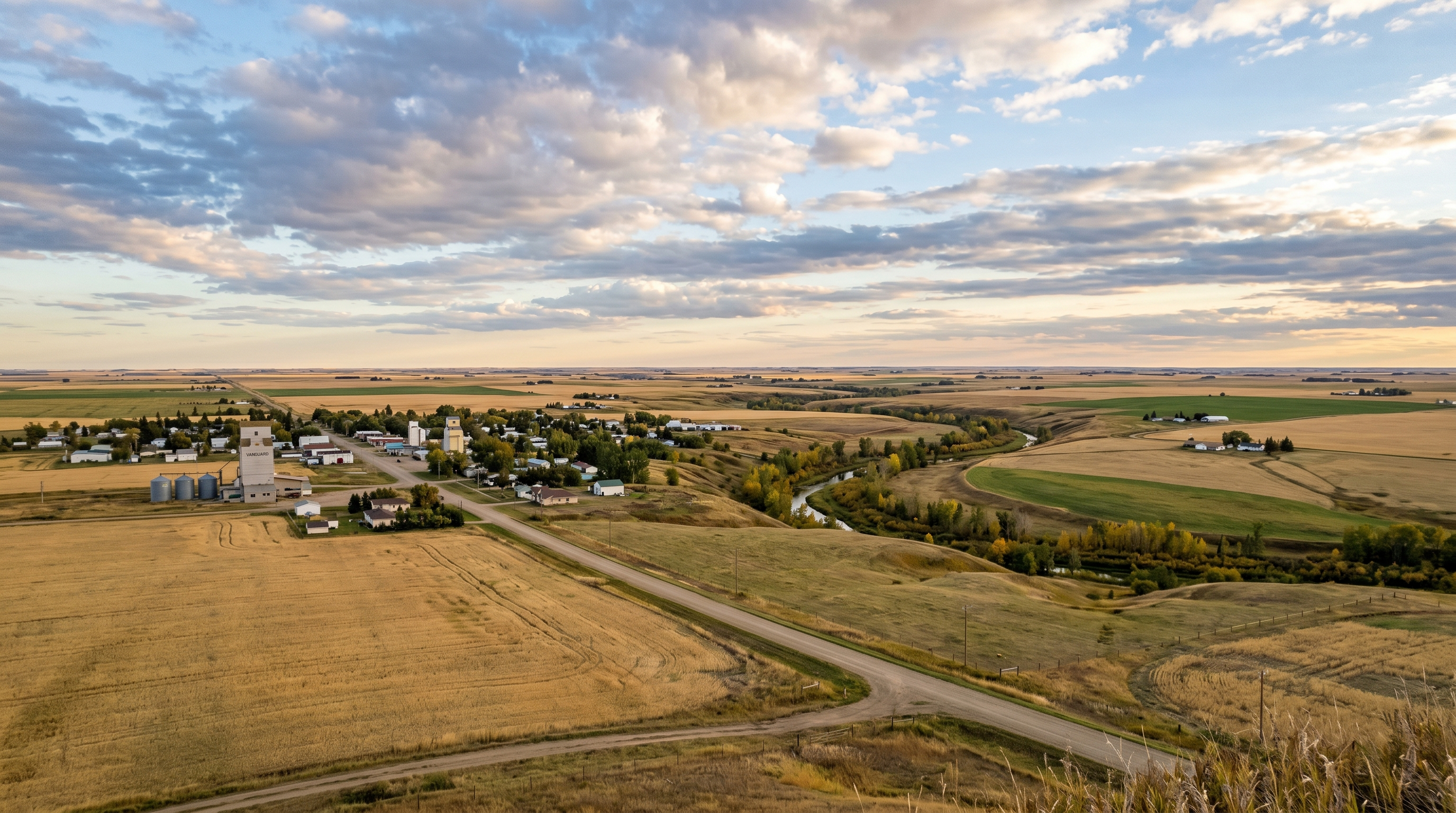
Vanguard carries a different kind of local story because of the flood of 2000. Events like that do not always become major travel-history markers, but they stay in community memory. They shape how people talk about land, drainage, roads, weather, and what it means to live in a place where conditions can turn quickly.
For visitors, Vanguard is not about arriving and seeing one major attraction. It is about understanding that small towns are shaped by moments that outsiders rarely hear about. A flood, a hard year, a rebuilding effort, a story repeated by locals. Those things do not always show up on tourism pages, but they are part of why the town feels the way it does.
This is the kind of stop that gives the article its real Saskatchewan texture. Not every place has to be dramatic. Some places matter because they show how communities adapt, remember, and keep going.
Hallonquist and the Sinking Hills
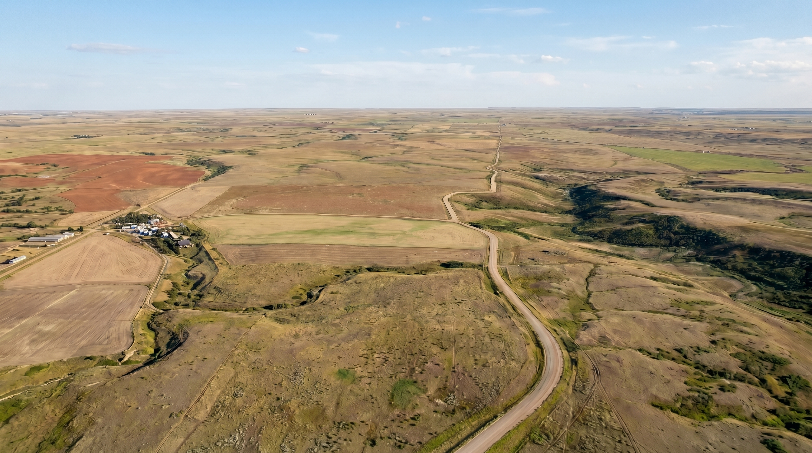
This image is a visual representation based on terrain and location reference. It is not a direct photograph.
Hallonquist belongs in this cluster because it captures the heart of what this article is trying to explain. It is a small community known locally for its rodeo, but it also sits near one of those places that simply would not exist in a normal travel guide: the Sinking Hills.
I first learned about the Sinking Hills as a kid. It was one of those spots down an old dirt road that you would take company to see, not because it was spectacular, but because it was strange enough to point out. Directly across from the Turkey Track Ranch area north of Hallonquist, the land tells a quiet story if you know where to look.
What started as hills on either side gradually changed as the middle portion dropped into what is now a gully filled with prairie flora, fauna, and Saskatoon bushes. You can still see the original hill shape on both sides. That is what makes it feel odd. It is not dramatic in a postcard sense. It is more like the land paused mid-sentence and left you to figure out what changed.
Could someone see it today? Yes, but they would need to know where they are looking. It is roadside visible, but it kind of just appears. That is why it belongs here. The Sinking Hills are not a tourist attraction. They are a local memory tied to land, farmers, family drives, and the kind of prairie knowledge that usually disappears unless someone writes it down.
Why this cluster is a gem: South-central Saskatchewan proves that hidden gems are not always visual attractions. Sometimes they are cultural roots, small-town memory, sports history, flood history, and subtle land features that only locals know to point out.
Best time: June through September for easier roads, visible landscapes, and small-town travel that feels relaxed instead of rushed.
3. Southeast Saskatchewan: Working towns, coal country, and quiet prairie depth
Southeast Saskatchewan often gets skipped in hidden gem conversations because it does not always deliver one obvious “wow” stop. That does not mean it lacks interest. It means the region’s appeal is quieter and more tied to working landscapes, rural communities, and the way industry, agriculture, and small towns overlap.
Weyburn and Estevan can work as practical anchors, especially if you are moving through the southeast as part of a larger route. You are not necessarily building the whole trip around them. You are using them to understand another side of Saskatchewan, one that feels less like open-range badlands and more like the everyday engine of the province.
Weyburn
Weyburn is one of those cities that makes more sense when you treat it as a regional centre rather than a classic attraction. It gives you services, food, lodging options, and a sense of place between the quieter communities around it. For road trippers, that matters more than people think.
The hidden gem value here is not one specific photo stop. It is the way Weyburn helps frame southeast Saskatchewan as lived-in rather than empty. It gives structure to a route that could otherwise feel like scattered roads and small towns without a centre point.
If you are trying to explore the southeast properly, Weyburn becomes useful as a reset. Fuel up, slow down, look around, and understand that this region is not trying to perform for visitors. It is simply functioning, which is part of why it feels different from the more scenic clusters.
Estevan
Estevan adds another layer through energy, coal history, and its position near the southeast edge of the province. Like Weyburn, it is not a hidden gem in the “secret viewpoint” sense. It is a regional anchor that helps explain the area around it.
For travelers who like understanding how places work, Estevan offers context. It sits in a part of Saskatchewan where industry and prairie identity overlap, and that gives the region a different feel from the ranching history of the southwest or the lake-and-valley character farther north.
This cluster is worth including because Saskatchewan is not only strange landscapes and historic towns. It is also working communities, resource history, and road networks that most travelers ignore because they are looking for prettier words than “practical.” Sometimes practical is the story.
Why this cluster is a gem: Southeast Saskatchewan shows the working side of the province. It is less about one major attraction and more about understanding the communities, roads, and industries that shape the region.
Best time: Late spring through early fall, especially if you are combining it with south-central or central-east stops.
4. Central-East Saskatchewan: Underground stories, Dog River, and valley country
This cluster works because it blends recognizable places with deeper layers. Moose Jaw has tunnels. Regina gives you a major logistics base. Roleau gives you Dog River and Corner Gas. Fort Qu’Appelle gives you a valley landscape that feels like a completely different chapter in the province.
Central-east Saskatchewan is one of the easiest clusters to build into a trip because the distances are more manageable and the stops are more structured. If someone is nervous about exploring Saskatchewan’s quieter regions, this is a good place to start. You get hidden layers without needing every stop to be down a gravel road with no sign and a suspiciously confident uncle giving directions.
Moose Jaw and the Tunnels
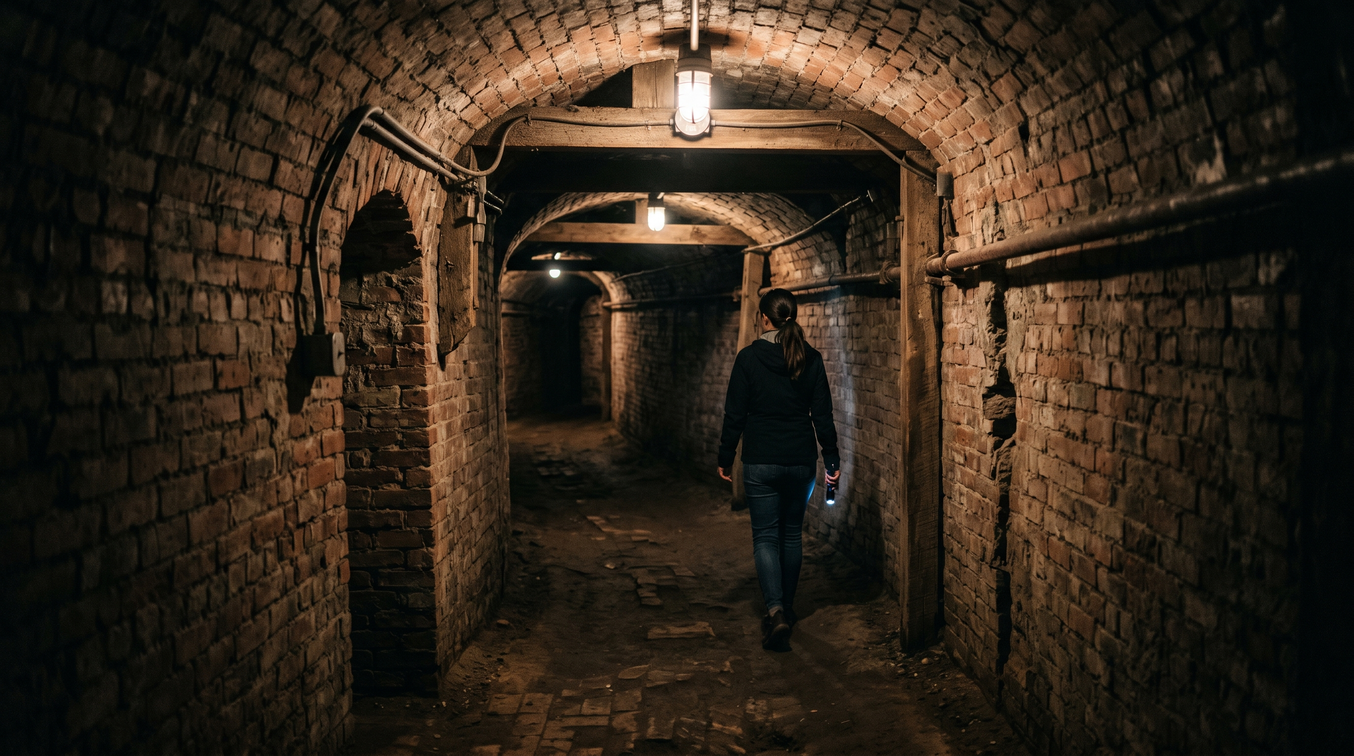
Moose Jaw is one of the few places in Saskatchewan where the hidden story is literal. The Tunnels of Moose Jaw take visitors underground into theatrical tours built around stories from the city’s past, including prohibition-era themes and Chinese immigration history. It is more structured than most stops in this article, but it still fits because it reveals a layer of the province most people would never see from street level.
That structure matters for travelers. Not every hidden gem has to be unmarked or informal. Sometimes the best version of a hidden story is one that has been preserved, interpreted, and made accessible. Moose Jaw does that in a way that gives visitors a real experience instead of just another roadside note.
It also pairs well with a broader Saskatchewan route because Moose Jaw offers food, hotels, walkable areas, and a logical base before moving toward Regina, Roleau, or the Qu’Appelle Valley. In a province where some hidden gems are subtle and difficult to explain, Moose Jaw gives you one that is easy to plan and still interesting.
Regina as a route anchor
Regina is not being included here as a hidden gem in the same way as the Sinking Hills or Big Muddy. It is included because it is one of the most practical anchors for building a Saskatchewan hidden gems route. You can use Regina as a place to reset, stay overnight, restock, and branch out to Moose Jaw, Roleau, Fort Qu’Appelle, and southeast communities.
That kind of role matters in real travel planning. If an article only lists small places without explaining how to connect them, it becomes interesting but not useful. Regina gives the route structure, especially for visitors flying in, renting a vehicle, or wanting a stable base before exploring smaller towns.
It also helps balance the trip. After long rural stretches, a city stop gives you choices. Food, accommodations, fuel, supplies, and a place to regroup. That is not glamorous, but it is exactly what makes the rest of the exploring easier.
Roleau, better known as Dog River

Roleau is one of those places people may recognize before they understand it. For many visitors, the connection is Corner Gas and Dog River. That gives the town a pop-culture doorway, but the reason it belongs in this article is because it still feels like a real prairie town, not a place rebuilt around nostalgia.
That is what makes it work. You can visit because of the show, take your photos, recognize the setting, and still feel like you are standing in a community rather than a manufactured attraction. That balance is rare. A lot of filming locations either vanish into normal life or become overly packaged. Roleau sits somewhere in between.
As part of a Saskatchewan hidden gems route, Roleau adds personality. It gives readers something familiar, but it also supports the bigger idea: small towns here often carry more story than their size suggests. Sometimes that story is local. Sometimes it ends up on national television. Either way, the town remains itself.
Fort Qu’Appelle Valley
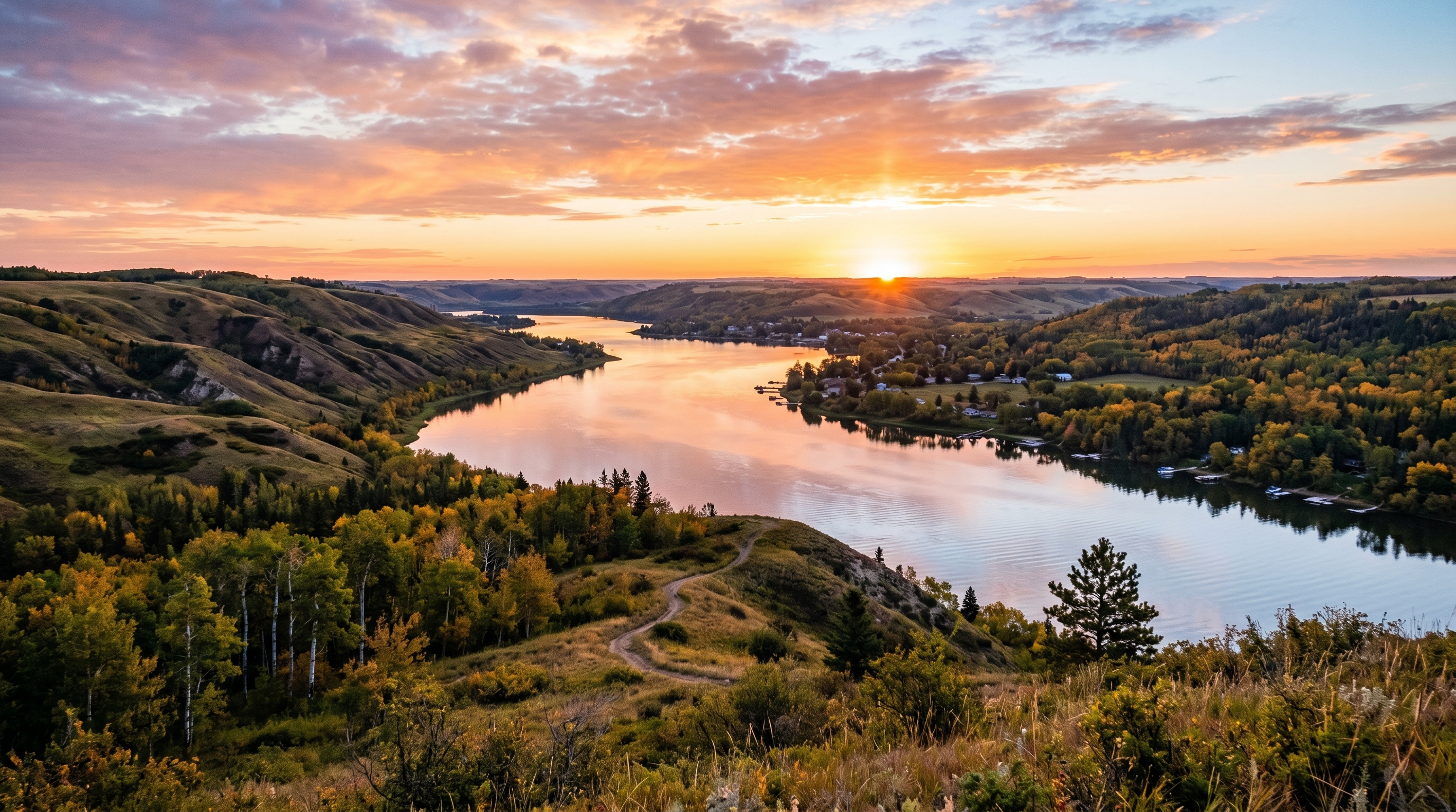
Fort Qu’Appelle and the surrounding valley shift the landscape again. The land drops, the lakes sit low, and the province suddenly feels less horizontal. It is not as abrupt as Castle Butte or as strange as the Great Sand Hills, but it changes the rhythm of the trip in a way that people notice.
This is a strong stop because it gives Saskatchewan a softer visual contrast. You are not just looking for oddities anymore. You are seeing how the province changes through valleys, water, history, and settlement patterns. The Qu’Appelle area has long been significant, and you feel that layered quality when you move through it.
It works well in late summer or fall, when the valley has colour and the light sits lower. It is also a good reminder that hidden gems do not always need to be secret. Sometimes they are places people know about locally, but outsiders still underestimate because they never imagined Saskatchewan having this kind of landscape.
Why this cluster is a gem: Central-east Saskatchewan combines accessible experiences with deeper layers: underground history, pop culture, city logistics, and valley scenery.
Best time: Late summer and September work especially well, with good driving conditions, valley scenery, and comfortable town stops.
5. North-Central Saskatchewan: Water, Indigenous history, and river valleys
North-central Saskatchewan gives the route a different kind of depth. By this point, the trip has moved beyond prairie roads and small towns into water systems, major cultural sites, and places that explain the province through much older timelines.
This cluster can be built around Saskatoon, Outlook, Lake Diefenbaker, Wanuskewin, and Batoche. It is one of the strongest sections for travelers who want more than scenery. Here, the hidden gem idea becomes less about “unknown” and more about “understood properly.”
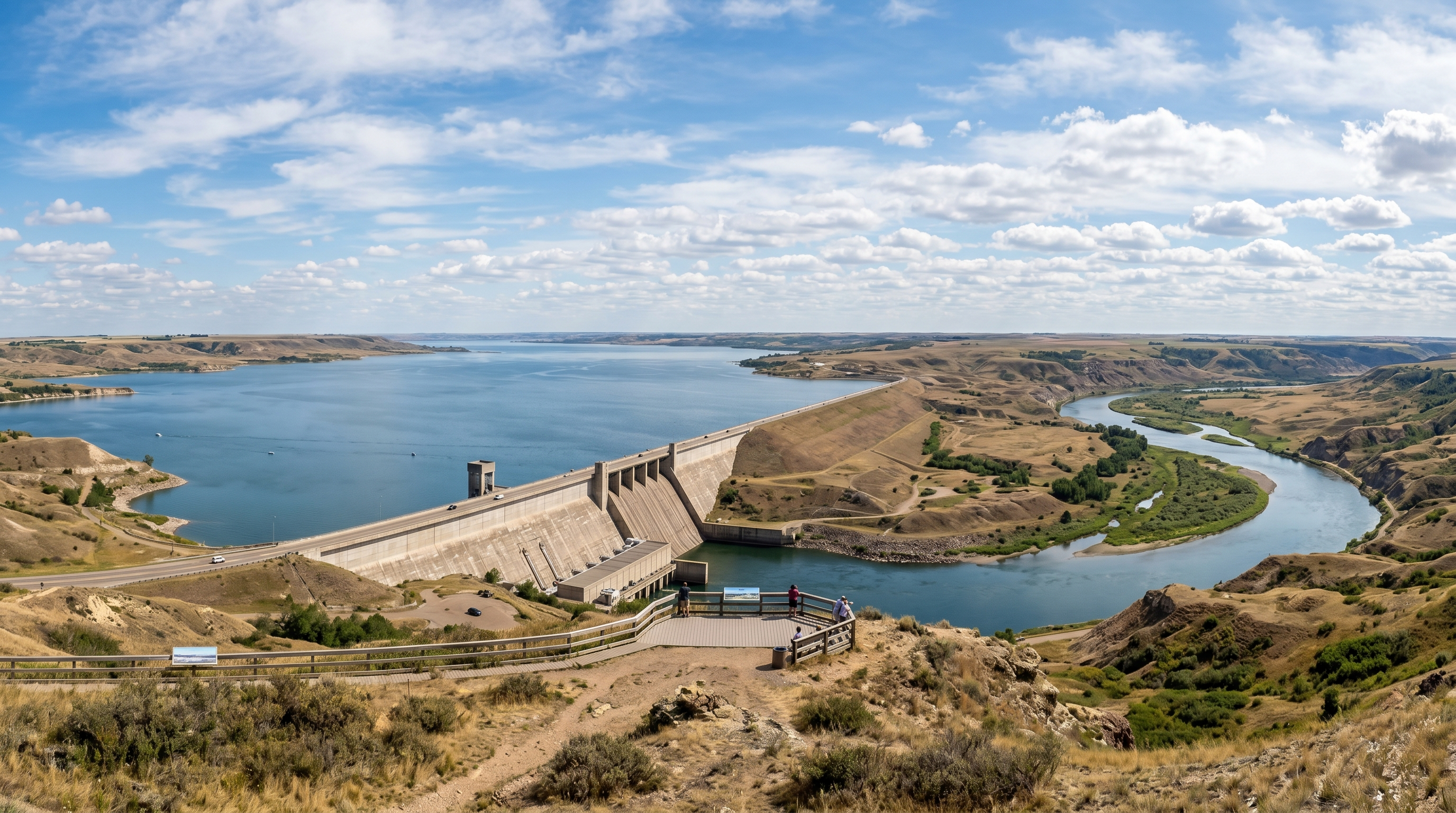
Lake Diefenbaker, Outlook, and Gardiner Dam
Lake Diefenbaker is one of the clearest examples of Saskatchewan doing something bigger than expected. The scale of the water, the dam, the valley edges, and the open sky all work together to create a stop that feels more substantial than many travelers assume they will find in the province.
Outlook and the surrounding area can work as a softer entry into this cluster. You get river valley scenery, water access, and a break from the long prairie-road rhythm. Gardiner Dam adds another layer because it is not just scenic. It is infrastructure that changed the region, and that makes it worth understanding rather than simply photographing.
This area works especially well for people who want a road trip to include water without heading fully north. It pairs naturally with Saskatoon, Wanuskewin, and Batoche if you want to build a more complete north-central route.
Wanuskewin Heritage Park
Wanuskewin belongs in this article because it carries a depth that completely changes the way you think about Saskatchewan. Located just outside Saskatoon, it is a National Historic Site with thousands of years of Northern Plains Indigenous history, archaeological significance, walking trails, cultural interpretation, and a landscape that has functioned as a gathering place for generations.
This is not a casual “hidden gem” in the same way as an unmarked roadside stop. It is known, important, and actively interpreted. But many travelers still underestimate it because they do not understand how much history exists on the land before highways, towns, farms, forts, and provincial borders.
If the Sinking Hills represent local memory, Wanuskewin represents deep memory. It stretches the article beyond small-town curiosity and reminds readers that Saskatchewan’s hidden depth is not only recent, rural, or settler-focused. It goes much farther back.
Batoche
Batoche is one of the strongest historical additions to a Saskatchewan hidden gems route because it ties directly into Métis history and the North-West Resistance. It is not a random stop. It is part of the province’s deeper story and helps connect the Battlefords, Wanuskewin, and the broader historical landscape of central and northern Saskatchewan.
For travelers, Batoche works best when it is approached with time and respect. This is not a quick novelty stop. It is a place where context matters, and where the story is much bigger than what can be understood from a roadside glance.
Including Batoche also prevents the article from becoming only about quirky places. Saskatchewan’s hidden gems include strange landscapes and small-town memories, yes, but they also include places where Canadian history becomes much more complicated and much more real.
Why this cluster is a gem: North-central Saskatchewan adds water, Indigenous history, archaeology, river valleys, and national historic context. It gives the route emotional and cultural depth.
Best time: June through September for trails, outdoor interpretation, and easier movement between Saskatoon, Outlook, Wanuskewin, and Batoche.
6. Northwest Saskatchewan: The Battlefords, forest transition, and northern scale
The northwest cluster feels different because it begins to pull the route toward northern Saskatchewan. The land opens in a new way, history becomes heavier around the Battlefords, and eventually the forest-and-lake character of places like Prince Albert National Park and Waskesiu starts to take over.
This is a strong final cluster because it gives the article scale. Saskatchewan is not just south prairie, small towns, and badlands. It also stretches toward boreal forest, lake country, and places where the history of settlement, policing, Indigenous nations, and Canadian expansion becomes impossible to ignore.
The Battlefords
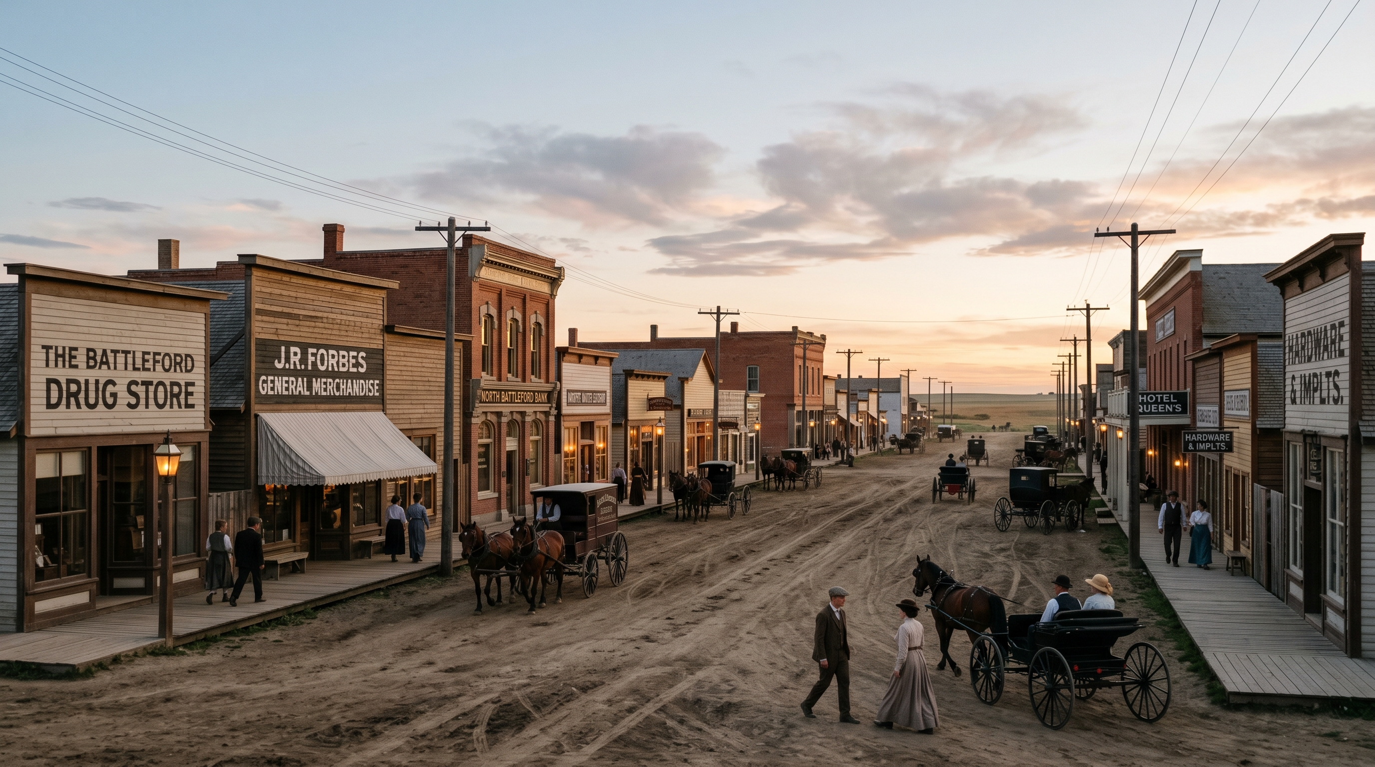
The Battlefords need more than a passing mention because this region carries some of Saskatchewan’s most important and difficult history. Fort Battleford was established as a North-West Mounted Police post in 1876, and the area played a central role during the conflict of 1885. That history involves First Nations, Métis, police, settlers, fear, displacement, resistance, and competing versions of what the Canadian west was becoming.
That is why the Battlefords are not a simple “hidden gem” in the scenic sense. They are a context stop. If you are trying to understand Saskatchewan beyond road-trip scenery, this area matters because it forces the trip to become more serious. It asks you to think about whose stories are being told, whose are missing, and how history sits inside places that may look quiet today.
For travelers, Fort Battleford National Historic Site is the most direct way to engage with that history. It gives the region structure and makes it easier to move beyond vague references. If Moose Jaw gives you theatrical history underground, the Battlefords give you heavier, more foundational history above ground.
Prince Albert National Park and Waskesiu
Prince Albert National Park and Waskesiu shift the route again by bringing in forest, lake, wildlife, and a more northern travel feel. After the prairie, badlands, valleys, and small towns, this part of Saskatchewan feels like the province changing clothes.
Waskesiu works well because it gives visitors a recognizable base without losing the natural setting. You can build the trip around lake time, trails, scenic drives, wildlife viewing, and the slower rhythm that comes with northern park travel. It is more known than some places in this article, but still often overlooked by travelers who only associate Saskatchewan with farmland.
This cluster helps close the loop because it shows the province’s range. By the time you reach this point, Saskatchewan is no longer one thing. It is badlands, rodeo towns, French-rooted communities, flood stories, pop culture towns, tunnels, valleys, Indigenous history, national historic sites, lakes, forest, and long roads between all of it.
Meadow Lake and the far northwest
If you want to push farther, the Meadow Lake region adds even more northern scale. It is not always realistic for a shorter hidden gems trip, but it belongs in the conversation because it shows how much of Saskatchewan exists beyond the southern routes most people know.
This is where trip planning becomes more serious. Distances get longer, services can be more spread out, and you need to be honest about how much ground you want to cover. But for travelers who like lake country, forest roads, and quieter northern movement, it expands the article beyond the obvious southern loop.
It is best treated as an extension, not a required stop. That keeps the route realistic while still giving readers a sense that Saskatchewan does not end where the main highways get tired.
Why this cluster is a gem: Northwest Saskatchewan adds historical weight and northern contrast. The Battlefords bring serious context, while Prince Albert National Park and Waskesiu shift the route into forest and lake country.
Best time: Summer into early fall for park access, lake time, trails, and comfortable driving conditions.
Best time to visit Saskatchewan hidden gems
The best time to explore hidden gems in Saskatchewan is usually late May through September. That gives you the best mix of road access, daylight, warmer weather, and visible landscapes. If your route includes remote gravel roads, badlands, grasslands, or small-town detours, this window is much easier to work with than winter or early spring.
June is a strong month because the land is greener and the heat is usually more manageable. July and August offer the most predictable travel conditions, but they can be hot and dry, especially in the southwest and grasslands areas. September might be the best overall month if you want quieter travel, softer light, and a pace that fits this type of trip.
| Season | Best for | Watch for |
|---|---|---|
| Late May to June | Green landscapes, comfortable temperatures, early road trip season | Some rural roads can still be affected by spring conditions |
| July to August | Long days, easiest access, summer events, park visits | Heat, exposure, busier parks, stronger sun in open landscapes |
| September | Quieter travel, better light, cooler driving days | Shorter days and more variable weather |
| Winter | City-based stops like Moose Jaw or larger town anchors | Road conditions, limited rural access, reduced landscape visibility |
How to plan this trip without making it miserable
The biggest mistake is trying to treat Saskatchewan like a compact destination. It is not. Distances are long, services can be spread out, and the best stops are often not directly beside each other. If you try to cram too much into one day, you will spend more time driving than noticing anything.
The better approach is to pick two or three clusters for a shorter trip, or build a longer loop if you have the time. Use larger towns as anchors, then explore outward. That means places like Swift Current, Maple Creek, Regina, Moose Jaw, Saskatoon, North Battleford, and Prince Albert become practical bases rather than just map labels.
Build the route around time, not distance
Saskatchewan looks simple on a map until the kilometres start stacking up. Pick your clusters, choose solid overnight bases, keep your vehicle plan flexible, and leave room for the stops you did not know you were going to care about.
Frequently asked questions
What are the best hidden gems in Saskatchewan?
Some of the best hidden gems in Saskatchewan include the Big Muddy badlands, Castle Butte, the Great Sand Hills, the Sinking Hills near Hallonquist, the Tunnels of Moose Jaw, Roleau, Fort Qu’Appelle Valley, Wanuskewin, Batoche, and the Battlefords.
Is Saskatchewan worth visiting?
Yes, especially if you enjoy road trips, quiet landscapes, small-town stories, history, and places that are not heavily built around tourism. Saskatchewan is not a checklist destination. It works best when you slow down and explore by region.
Do you need a car to visit hidden gems in Saskatchewan?
Yes. A car is essential for most hidden gems in Saskatchewan because many are spread across rural regions, gravel roads, small towns, parks, and scenic areas with limited public transportation.
When is the best time to explore Saskatchewan hidden gems?
Late May through September is usually the best window. June offers green landscapes and comfortable weather, July and August offer the easiest access, and September is excellent for quieter travel and softer light.
Are the Sinking Hills a public tourist attraction?
No. The Sinking Hills near Hallonquist are best described as a local-known landscape feature rather than an official tourist attraction. They are roadside visible if you know where to look, but they are not marked or promoted like a formal destination.
What is the best Saskatchewan road trip route for hidden gems?
A strong route starts in southwest Saskatchewan around Maple Creek, Cypress Hills, Grasslands, and Big Muddy, then moves through south-central towns, central-east stops like Moose Jaw and Roleau, north-central history around Saskatoon and Wanuskewin, and northwest stops like the Battlefords and Prince Albert National Park.
Are Saskatchewan hidden gems good for families?
Many are, but planning matters. Structured stops like Moose Jaw, Wanuskewin, Fort Battleford, and major parks are easier for families. More remote rural stops require careful driving, fuel planning, water, and realistic expectations.
Leave a Reply